 Ask Us
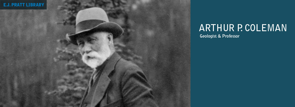
Professional files
Title: Professional files
Dates of Material:
[1882?]–[1938?]
Extent:
60 cm of textual records
11 maps
11 maps
Series consists of A.P. Coleman’s geological notes and field notebooks, notes for lectures and slide shows, letters-to-the-editor, 9 maps highlighting the geology and topography of Toronto and Ontario, a map of Mt. Robson in British Columbia, and a geological map of the Southern Transvaal in South Africa.
NOTE(S)
Source of supplied title
Title based on contents of series.
Extent
The series is stored in 10 boxes.
Finding aids
File list available (see below).
| BOX | FILE | TITLE | YEAR | ADDITIONAL INFORMATION |
| Box 1 | ||||
|---|---|---|---|---|
| Field notebooks | ||||
| 1 | 10 | Alberta, British Columbia | 1888 | Including Donald, Yale, Vancouver, Victoria, Washington, Oregon. 1888. |
| 1 | 11 | Alberta (Banff); Germany. | 1888, 1891 | |
| 1 | 12 | Rocky Mountains and British Columbia coast | 1892 | Includes list of Cree words. 1892. |
| 1 | 13 | Rocky Mountains and British Columbia coast | 1892 | Rocky Mountains. 1892. |
| 1 | 14 | Rocky Mountains and Kootenay region | 1893 | |
| 1 | 15 | Rocky Mountains and Kootenay region | 1893 | Alberta and British Columbia (Red Deer, the Rocky Mountains, Clearwater, Kootenay Plains). 1893. |
| 1 | 16 | Rocky Mountains and Kootenay region | 1893 | Athabasca region. 1893. |
| 1 | 17 | Rocky Mountains and Kootenay region | 1893 | |
| 1 | 18 | Rocky Mountains and Kootenay region | 1893 | |
| 1 | 19 | Ontario (Rainy Lake) | 1894 | |
| 1 | 20 | Ontario (Rainy Lake) | 1894 | Upper Manitou Lake, Brule Portage. 1894. |
| 1 | 21 | Ontario (Shoal Lake, Sand Point, Lac des Milles Lacs) | 1895 | |
| 1 | 22 | Ontario (Shoal Lake, Sand Point, Lac des Milles Lacs) | 1895 | Savanne, Windsor. 1895. |
| Box 2 | ||||
| 2 | 23 | Ontario (Windsor, Yellow Girl Bay) | 1896 | |
| 2 | 24 | Ontario (Windsor, Yellow Girl Bay) | 1896 | Ontario (Rat Portage, Fort William). 1896. |
| 2 | 25 | Ontario (Rat Portage, Lake of the Woods, Manitou, Shoal Lake, Fort William, Missanabie) | 1897 | |
| 2 | 26 | Ontario (Shoal Lake, Collingwood, Bruce Mines) | 1898 | |
| 2 | 27 | Ontario (Shoal Lake, Collingwood, Bruce Mines) | 1898 | Heron Bay, Pucaswa. 1898 |
| 2 | 28 | Ontario (Fort William, Thunder Bay, Parry Sound), Michigan, Minnesota | 1899 | |
| 2 | 29 | Ontario (Sudbury, Meteor Lake, Clear Lake, Helen Mine, Owen Sound) | 1900 | |
| 2 | 30 | France, Ontario (Brighton, Trenton, Rideau, Scarborough, Helen Mine, Michipicoton Harbour) | 1900 | |
| 2 | 31 | Ontario (Helen Mine, Lake Eleanor, Algoma, Port Coldwell, Slate Islands) | 1901 | |
| 2 | 32 | Ontario (Helen Mine, Lake Eleanor, Algoma, Port Coldwell, Slate Islands) | 1901 | Ontario (Kamimistiquia, Sturgeon Lake, Port Colborne), Yukon (DawsonCity), Washington (Seattle). 1901. |
| 2 | 33 | Ontario (Sudbury) | 1902 | |
| 2 | 34 | Ontario (Sudbury) | 1902 | Sudbury, Rat Portage. 1902. |
| 2 | 35 | Ontario (Sudbury) | 1902 | Manitoba, Alberta (Calgary, Rocky Mountains), British Columbia (Vancouver, Victoria, Rivers Inlet, Skeena River Kootenay region), Ontario (Lake Superior). 1902. |
| 2 | 36 | Ontario (Sudbury) | 1903 | |
| 2 | 37 | Ontario (Sudbury) | 1903 | Sudbury.1903 |
| 2 | 38 | Ontario (Sudbury) | 1904 | |
| 2 | 39 | Ontario (North Bay, Michipicoton) | 1905 | |
| 2 | 40 | Ontario (North Bay, Michipicoton) | 1905 | Michpicotion. 1905. |
| 2 | 41 | Ontario (Lake Nipigon, Standing Stone Lake) | 1906 | |
| 2 | 42 | Ontario (Lake Nipigon, Standing Stone Lake) | 1906 | Ontario (Standing Stone Lake, Sturgeon), United States (Ticonderoga, Mineville), Ontario (Kingston, Tweed, Lancaster, Haliburton), Mexico. 1906. |
| 2 | 43 | Ontario (Lake Nipigon, Standing Stone Lake) | 1906 | Mexico, Ontario (Keewatin, Ingersol, Stouffville, Lemonville, St. Thomas, Temagami, Nipigon). 1906–07 |
| Box 3 | ||||
| 3 | 44 | Ontario (Lake Nipigon, Standing Stone Lake) | 1907 | Nipigon, Ombabika Post. 1907. |
| 3 | 45 | Ontario (Lake Nipigon, Standing Stone Lake) | 1907 | Ontario (Ombabika, Lake Nipigon), Alberta and British Columbia (Banff, Grand Forks). 1907. |
| 3 | 46 | Ontario (Little Long Lake, Port Arthur, Black Sturgeon River) | 1908 | |
| 3 | 47 | Ontario (Little Long Lake, Port Arthur, Black Sturgeon River) | 1908 | Ontario (Black Sturgeon Lake), Alberta (Edmonton, Mount Robson). 1908 |
| 3 | 48 | Britain, Italy | 1909 | [Some entries by Helena Coleman?] 1909–10. |
| 3 | 49 | England, Sweden, Germany, France, Italy; local field trips (Toronto area); Norway, England, New York; Ontario (Larchwood, Sudbury) | 1910-1911 | |
| 3 | 50 | Nova Scotia, Prince Edward Island, New Brunswick, Quebec, Idaho, Nebraska, Kansas, Iowa, Ontario (local field trips), New York, South America (Rio de Janeiro, Sao Paulo, Santa Maria, Montevideo, Buenos Aries) | 1916-1917 | |
| 3 | 51 | Nova Scotia, Prince Edward Island, New Brunswick, Quebec, Idaho, Nebraska, Kansas, Iowa, Ontario (local field trips), New York, South America (Rio de Janeiro, Sao Paulo, Santa Maria, Montevideo, Buenos Aries) | 1917 | South America (Buenos Aries, San Juan, Santiago, La Paz), Panama, New York. 1917. |
| 3 | 52 | Ontario-Manitoba border | 1921 | |
| 3 | 53 | Adirondack Mountains | 1924 | |
| 3 | 54 | Ontario (Sudbury), Quebec, New York (Lake Placid), New Brunswick, Nova Scotia, Newfoundland | 1924 | |
| 3 | 55 | New York (Lake Placid), Ohio, Kentucky, Tennessee, North Carolina, Georgia, Quebec, Nova Scotia, Newfoundland | 1924-1925 | |
| 3 | 56 | New York (Lake Placid), Ohio, Kentucky, Tennessee, North Carolina, Georgia, Quebec, Nova Scotia, Newfoundland | 1925-1926 | Newfoundland, Ontario (“Pinehurst”), New York, Spain, France. 1925–26. |
| 3 | 57 | Quebec (Montreal, Magog, Quebec City, Eastern Townships), Ontario (Kingston, Morrisburg, Chesterville, Prescott, “Pinehurst,” local field trips, Hamilton), New York (Plattsburg, eastern coast), Newfoundland, Illinois (Chicago) | 1926-1927 | |
| 3 | 58 | Ontario (local field trips, Sudbury, Hamilton, Owen Sound, Georgian Bay, “Pinehurst”), Manitoba (Winnipeg), Michigan, Wisconsin,... | 1928-1929 | ...Minnesota, Alberta (Calgary, Banff), Quebec (Montreal), England, Spain, southern Africa (Cape Town, Kimberley, Johannesburg, Pretoria). 1928–29 |
| 3 | 59 | Continuation of Box 3, No. 58 | 1929-1930 | Southern Africa, England, Ontario (local field trips, North Bay, Owen Sound), Manitoba, Alberta (Edmonton, Jasper). 1929–30. |
| 3 | 60 | Ontario (Trenton, Kingston, local field trips), New York, Cuba | 1933-1934 | |
| 3 | 61 | Ontario (Trenton, Kingston, local field trips), New York, Cuba | 1934 | Cuba, Panama, Guatemala, California (San Francisco), Connecticut, Ontario (local field trips, Niagara River). 1934. |
| 3 | 62 | Ontario (local field trips), New York, Jamaica, Cristobel, Cartagena, San Antonio, San Miguel | 1934-1935 | |
| 3 | 63 | Ontario (local field trips), New York, Jamaica, Cristobel, Cartagena, San Antonio, San Miguel | 1935-1936 | San Miguel, San Antonio, New York, Virginia, North Carolina, Kentucky, Ohio, Quebec, Britain, Illinois, California, Mexico, Ontario (Sudbury, Cobolt, Timmins), Alberta and British Columbia (Edmonton, Jasper, Vancouver, Victoria, Banff). 1935–36. |
| 3 | 64 | Ontario (local field trips), Pennsylvania, Central and South America, Georgia, Quebec, Montana, Nevada, Florida, eastern coast of United States | 1936-1938 | |
| Notes for lectures and slide shows | ||||
| 3 | 65 | Including speech notes relating to travels on several continents, some notes for slide shows | ||
| Box 4 | ||||
| Notes, geological | ||||
| 4 | 6 | Notes, geological, copied | 1934 | ts., “copied from original by Bob Dyson” |
| 4 | 19b | On work done [by whom?] north of Latitude 79 | ||
| 4 | 19c | On available books about the Arctic | ||
| Notes for lectures and slide shows | ||||
| 4 | 19g | Notes for slide shows on ice ages | ||
| Box 8 | ||||
| Maps | ||||
| 8 | b.6 | Geological map of the Southern Transvaal / by Frederick H. Hatch | 1903 | Scale 1:3.5, where 1 inch is 3.5 miles. 1 map : col. mounted on linen ; 70 x 105 cm Includes an inscription to Coleman on the front of the map. |
| 8 | b.7 | Mt. Robson: n.d. | n.d. | Scale 1:1, where 1 inch is 1 mile. 1 map : hand col. ; 28 x 36.5 cm A hand drawn map on card paper of Mt. Robson in British Columbia. Transferred from Box 5. |
| Box 9 | ||||
| Letters-to-the-editor | ||||
| 9 | a.1 | Of Nature | ||
| 9 | c.2 | Of Economic Geology | 1920 | |
| Box 22 | ||||
| Field notebooks | ||||
| 22 | 1 | Toronto, Scarboro, Hoggs Hollow, Don. McGown | 1894 | |
| 22 | 2 | Toronto, Whirlpool, Niagara, Hamilton, Bowmanville | 1895 | |
| 22 | 3 | Niagara, Toronto | 1896 | |
| 22 | 4 | Vermillion, Wahmapitac, Red Deer | 1897 | |
| 22 | 5 | London, Cornwall, Toronto, Mica Mines | 1898 | |
| 22 | 6 | Parry Sound, Copper, St. Lawrence, Toronto | 1899 | |
| 22 | 7 | Eastern Ontario, Hamilton, northern New York | 1902-1903 | |
| 22 | 8 | Eastern Ontario, Hamilton, St. Catharines, Toronto, Missouri, Sudbury region | 1903-1904 | |
| 22 | 9 | Sudbury Township, St. Lawrence | 1904 | |
| 22 | 10 | Grand Forks, Temagami, Toronto | 1907 | |
| 22 | 11 | Toronto, New Mexico, Crean Hill, Echo Bay | 1907 | |
| 22 | 12 | Elbow River, Calgary, Lake Ojibwa, Toronto, Alexo Mines, Copper Cliff | 1908-1909 | |
| 22 | 13 | Sudbury, Cobalt, Porcupine, Toronto | 1909 | |
| 22 | 14 | Norway, Sudbury | 1911 | |
| 22 | 15 | Sudbury, Buckingham, Toronto, Niagara, Hamilton | 1911-1912 | |
| 22 | 16 | Sudbury, Whiskey Lake, Long and Penage Lakes, Sillwood | 1912 | |
| 22 | 17 | Sudbury region, Scarboro Township, Toronto, Porcupine, Yukon, Alaska, Don | 1912-1913 | |
| 22 | 18 | Rome, Swizerland, Red Sea–Aden, Colombo, Freemantle, New Zealand, north Australia, Singapore | 1914 | |
| 22 | 19 | Malacca, Penang, Rangoon, Calcutta, Darjeeling, Nagpur, Bombay, Madras, Colombo, Kandy, Singapore, Hong Kong, Canton, Shanghai, Japan, Honolulu, San Francisco, Toronto | 1914 | |
| 22 | 20 | Toronto, Labrador, Port aux Basques, Battle Creek, Kamaktorvik | 1915 | |
| 22 | 21 | Kamaktorvik | 1915 | |
| 22 | 22 | Port aux Basques, Nakvak | 1915-1916 | |
| 22 | 23 | 1916 | ||
| 22 | 24 | St. Louis, Mont Jolie, Magdalan Islands, Ste. Anne des Monts, Shickshock (Mountains) | 1917-1918 | |
| 22 | 25 | Shickshock (Mountains) | 1918 | |
| 22 | 26 | Toronto, Los Angeles, Yosemite, Rouge River, Montreal, New Glasgow | 1918-1919 | |
| 22 | 27 | Ste. Anne, Tabletop, Cascapedia Lake, Madeleine, Mechine, Matano | 1919 | |
| 22 | 28 | Cascapedia, Lake Placid, Winnipeg, Lethbridge, Kamloops | 1919-1920 | |
| 22 | 29. c | British Columbia, Atlin, Ontario, Quebec | 1920-1922 | |
| 22 | 30 | Scotland, England, Belgium, Sudbury, Yellowstone, Pacific Coast | 1922-1923 | |
| 2017.05 | ||||
| 2017.05, Box 1 | ||||
| Maps | ||||
| 1 | 1 | No. 3 Mine Property | 1910 | Scale 1:500, where 1 inch is 500 feet. 1 map on 2 sheets : positive blueprint, hand col., mounted on linen ; 85 x 96 cm A hand coloured, positive blueprint map divided into 2 sheets denoting geology and topography of the No. 3 Mine Property. |
| 1 | 2 | No. 3 Mine D.D. Section "E" / The Canadian Copper Co. | [n.d.] | Scale 1:50, where 1 inch is 50 feet. 1 map : blueprint ; 74 x 44 cm A blueprint showing diamond drilling holes and the location of ore within each one. |
| 1 | 3 | Plan Vermillion Mine | 1909 | Scale 1:10, where 1 inch is 10 feet. 1 map : hand drawn, paper ; 28 x 47 cm / 1 map : hand drawn, linen ; 14 x 20 cm 2 copies of a hand drawn map of the Vermillion Mines. One copy was drawn on paper, the other was drawn on linen. |
| 1 | 4 | Vermilion Mine Maps / Prof. A.P. Coleman | [n.d.] | Scale indeterminable. 1 map : hand col. ; 48 x 61 cm / 1 map : hand col., linen ; 53 x 62 cm / 1 map : hand col. ; 50.5 x 40.5 cm 3 copies of a hand drawn topographic map of the Vermilion Mines with contour lines denoting elevation and markings highlighting drilling locations. One copy drawn on linen. |
| 2017.05, Box 2 | ||||
| 2 | 1 | Plan shewing [sic] top of cliff in front of Lot 19, Con C and Lots 20-23, Con B Tp. [Township] of Scarboro; also position of top of cliff September 1891 | 1891 | Scale 1:200, where 1 inch is 200 feet. 1 map : blueprint ; 78 x 104 cm 2 copies of a map, one copy in blueprint and the other in negative Vandyke print. |
| 2 | 2 | Map of Toronto and vicinity / Geology by A.P. Coleman and H.L. Kerr | [n.d.] | Scale 1:1, where 1 inch is 1 mile. 1 map : blueprint, mounted on linen ; 39 x 55 cm |
| 2 | 3 | Geological Map based upon surface exposures and diamond drilling / Porcupine Watborn G.M. Ltd. | [n.d.] | Scale 1:300 1 map : hand col. ; 26 x 36 cm A hand drawn, hand coloured map of Porcupine Reef in Northern Ontario denoting rock types. |
| 2 | 4 | Plan of part of Tp. [Township] of Scarborough shewing [sic] measurements to top of cliff / Prof. A.P. Coleman, Chemistry and Mining Bldg [Building], University of Toronto | ca. 1900 | Scale indeterminable. 1 map : diazo ; 55 x 82 cm / 1 map : blueprint ; 55 x 82 cm / 1 map : negative Vandyke print ; 55 x 82 cm 3 copies of a map of the Township of Scarborough highlighting parts of Con A, Con B, Con C and Con D, extending from the Township of York to the Township of Pickering. Copy one is a diazo, copy two is a blueprint, copy three is a negative Vandyke print. |
| 2017.05, Box 3 | ||||
| 3 | Map of northern parts of the Districts of Algoma and Nipissing, Province of Ontario / to accompany report of J.M. Bell ; 13th Report Bureau of Mines ; Director Thos. W. Gibson | 1904 | Scale 1:8, where 1 inch is 8 miles. 1 map : diazo, mounted on linen ; 65 x 70 cm, folded to 25 x 14 cm A map of the northern parts of Algoma and Nipissing highlighting the topography and geology of the area. | |