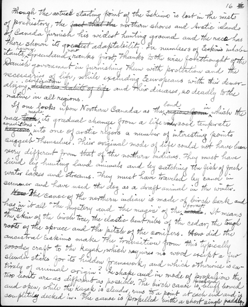
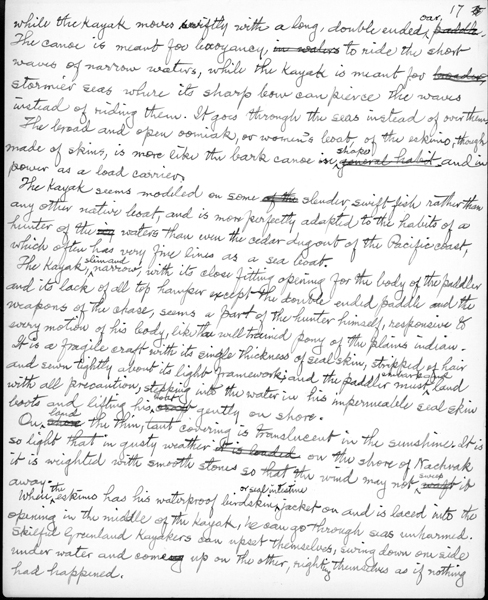
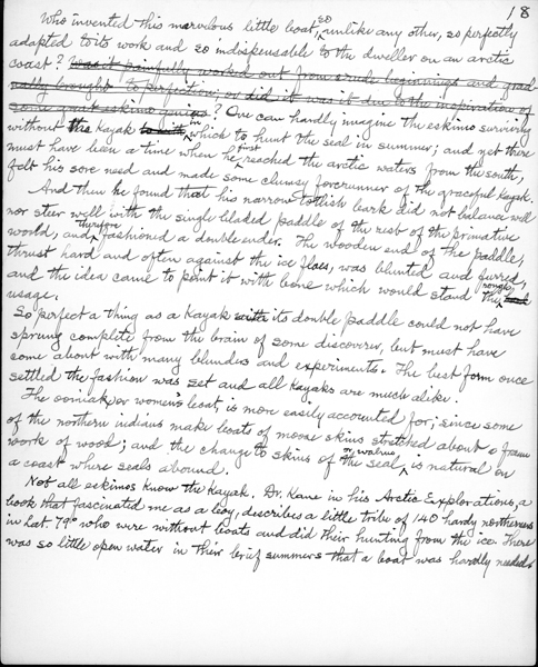
Coleman’s time in Labrador was spent fighting the elements. There were large squalls on the wild Atlantic sea and lots of cold, fog, snow and ice. Food consisted of dried meat or fresh seal or caribou accompanied by dried biscuits. The geologist was interested in the people he met and their adaptations to the climate and vegetation. For example, the manuscript “Men of the North” gives a detailed description of kayaks and how they differed from canoes.
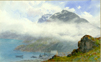
The most northerly exploration was in the area around Seven Islands Bay (also known as Komaktorvik Fiord). Coleman discovered a mountain and named it “Tetragona” after the heather growing on its flanks (4700 ft.). Later, he headed south to Nachvak Fiord where he climbed the Torngat Mountains, and found the tallest summit was approximately 5 000 feet. Once again Coleman had debunked the legend of 8,000 foot giants. The harsh weather with its bad ice conditions limited the time on the coast, so Coleman returned the following summer (1916), this time hiring two Newfoundland fishermen. The second trip covered the same area. On the second expedition Coleman charted and investigated the coast’s Precambrian and Pleistocene geology.
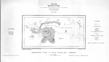
Coleman wrote a report on the area for the Geological Survey of Canada, “Memoir 124: Northeastern Part of Labrador and New Quebec.” Maps of Nachvak Fiord, Komaktorvik Fiord and the Northeastern portion of Labrador and New Quebec were published simultaneously with the Memoir in 1921. Coleman published a number of articles about his trips to Labrador, and took a lively interest in debates regarding the


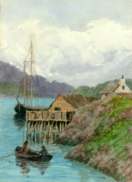


boundaries between Quebec and Newfoundland in the 1920s. Labrador features in Coleman’s arctic reminiscences and in many watercolour paintings.